|
| Photo of the Florida Mountains by John Fowler of Placitas, NM |
|
|
I got to La Mesa about 1:30 in the afternoon may 15. Bill and I had been talking for a few weeks and had come up with a list of places to find and explore. So, we went straight to Las Cruces and rented a four wheel drive vehicle. After breakfast May 16, we started west on Interstate
10 toward our first destination which was Fort Cummings and Cooke's Spring.
White men
discovered the spring during the Mexican-American War by a Mormon battalion traveling from Ohio to California . The spring was named after the battalion
commander, Captain Philip St. George Cooke and is located about 20 miles NW of present
day Deming. Captain Cooke was also the
name sake of a few other places in the area: Cooke’s Peak; Cooke’s Range and
Cooke’s Canyon.
The spring was the only sources of water within several days
ride in any direction, therefore, after it became well know, most folks heading
through this dry part of the country planned their route so they could stop
there and stock up on water. It didn’t take long for hostile Apaches in the
area to start raiding travelers who were stopped at the spring.
 |
| Plaque dedicated to The Mormon Battalion. |
In 1863 General James Carleton order a fort to be built near the spring to protect itinerate pale faces. He named it for Maj. Joseph Cummings, 1st New Mexico Cavalry who was killed that summer by Navajos in the Four Corners area. The fort also
served as a Butterfield Overland Mail station.
 |
| Round shelter and cover for Cooke's Spring. |
After the railroad was
built, water from Cooke's Spring was supplied to the neighboring village of
Florida. Now, the spring is capped off and protected by a round stone walled
structure with a wooden roof.
 |
| Suddenly, an old ruin appeared among the ancient adobe walls. |
Even with a nearby
source of water, it appears the soldiers led a rough life there in the desert and
were constantly harassed by Apaches. After the Civil War, freed slaves were
brought in to the Army and sent to Fort Cummings and many other forts in the
Desert Southwest. The Apaches called
these troops Buffalo Soldiers.Writer Walter Hill documented an account by Colonel Benjamin Grierson who said the Apaches and Comanches told him, what translates to, "We called them 'buffalo soldiers,' because they had curly, kinky hair...like bison".
I once heard a young
tour guide at Fort Concho tell a group of visitors the reason the Indians
called the black soldiers Buffalo Soldiers was because of their strong spirit
and strength. That is not true. The statement was a prime example of how
political correctness distorts the truth. Beware of history books written after
1964 because they are full of propaganda meant to push the agendas of special
interest groups.
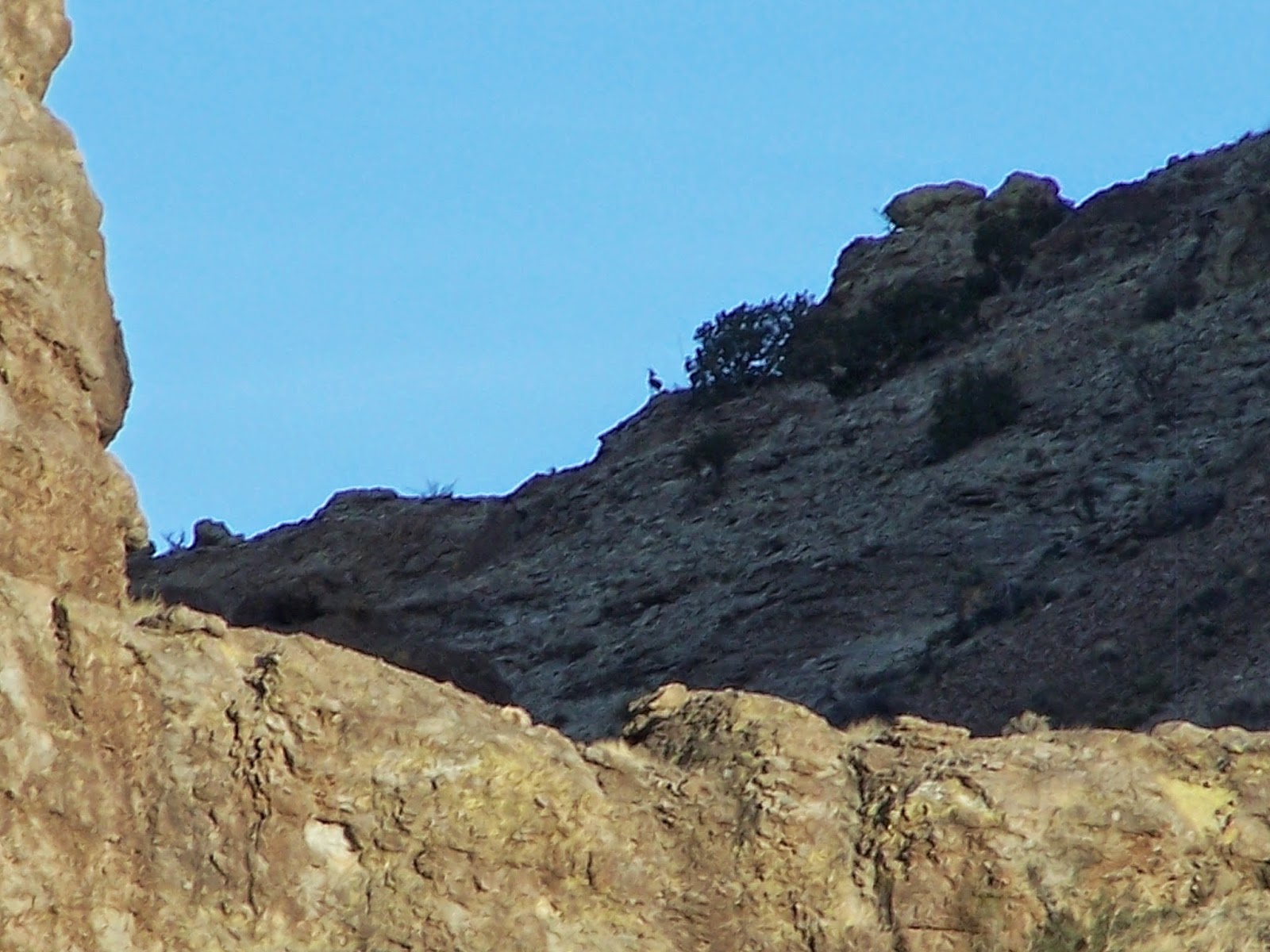
After we finished up at the Fort Cummings area
we went back to Deming and secured a couple of rooms for the night. Afterwards
we went south to the Florida Mountains to look for some Persian ibex. The Florida Mountains near Deming are the
only place in the US where Persian ibex roam freely. Biologists believe all
other goat species evolved from the Persian ibex. The ibex were stocked in the
Floridas in 1970 under the leadership of the then-director of the New Mexico
Department of Game and Fish, Dr. Frank C. Hibbens, who was a safari enthusiast
and the discoverer of the Sandia Man Cave. The ibex were a gift of a provincial
governor in Iran.
At first a handful of ibex were brought to the Floridas for hunters in
the winter hunting season. Their numbers have since stabilized at 400-450 under
Game and Fish management.
The
day before we started our trip we went to the BLM office in Las Cruces to get
some hints on where to see some ibex. The people there were friendly and very
helpful in telling us where to look. Fortunately we bought a BLM map before we
left. The map had very little detail and only the major roads were marked, however, when we left we forgot to put any other maps
in the car, so the BLM map was all we had.
We got around fine and found all
the places we were looking for, but it took a little extra time. That was OK though
because the weather was beautiful and it was fun driving around.
At dark we headed back to Deming
for dinner and then to the hotel to get some rest after a very full day.
After breakfast Saturday we headed west towards Lordsburg in search of a
place called Lower Gila Box Canyon. We had read the canyon was a place out in
the desert where the Gila River was surrounded by hills and cottonwood trees. A
soon as we left the pavement we were really glad we had rented an all-wheel
drive vehicle. Some of the route was sandy arroyo beds and other parts were
steep rocky trails.We wouldn’t have made it very far in my two wheel drive Tacoma.
 |
| Enjoying the solitude of a special place. |
|
|
|
The written directions we had printed off a web site said the
last leg of the trip to the river was 3.5 miles. After four miles we became
worried we had been given a bum steer. At 5.5 miles we decided to stop the
vehicle and I climbed up the side of a hill to take a look around. Only then
was I able to spot thick groves of cottonwood trees, so we pushed on.
We stopped the vehicle again and
went on foot looking for the river. We crossed several arroyos with cottonwood
trees by their sides. The tap roots of the trees were evidently living off the
underground flow of water which often accompanies surface water. There were
also lots of pretty spring flowers in the area. There was no litter or cigarette
butts. Not even any flies or gnats.
I just realized, as I was writing this, from the spot where I stood by the river I could look any direction and see no evidence another human had ever been there. That doesn't happen often.
 |
| Ocotillo blossom. |
 |
| Cholla blossoms. |
After we walked about ten minutes
were came to the river. It was beautiful, clear and cold. This was the Gila
River mentioned in many historic accounts of pioneer life in the Southwest. The
same Gila River which flows through western New Mexico then across Arizona until
it flows into the Colorado River at Yuma.
 |
| This is a look at a stretch of the hidden Gilla River. No sign of human life can be seen from this spot. |
I could have camped here for
days, but we had more places to go and more to see. So, after an hour we made
our way back out to the main road.
Our next destination was Silver
City, which was about fifty miles away. First we went to Western New Mexico
University and took in the museum. I have always been fascinated by the designs
on Mimbres pottery and this museum has the largest collection I’ve ever seen.
There is something about the combination of geometric designs, animal drawings,
and the black and white medium that mesmerizes me. I could have stayed there
all day, but we needed to go to the city museum and then find a couple of rooms
for the night.
 |
| This bowl is called an "exit bowl". When a person was buried, an exit bowl was placed over their face. The hole was the for the spirit to exit the body and enter the spirit world. |
We called around and
couldn’t find a vacancy so, when we finally stopped at one with a “Vacancy”
sign, we stopped and went in. The guy at the desk said there was only one room
and the price he quoted us was ridiculously high. When Bill asked the guy what was
going on in town that caused all the rooms to be taken he informed us there was
a wildfire north of town and firefighters had occupied the rooms.
We decided to go back
to Deming and stay at the same place we did the night before. I called to reserve
a room and after we checked in we decided to go back to Dragon Ridge and look
for some more ibex. Again, we saw only one, but it was well worth the drive and
the time.
That night at dinner we decided to go to Columbus the next morning
and then try to find Old Hachita which is an abandoned gold and silver mine.
After breakfast, Sunday, May 18, we drove down to Columbus
and went to the museum. It was all about Poncho Villas raid and his subsequent
butt whoopin’.
Thanks for looking.